
Drones and Construction: Maximizing the benefits while minimizing the risk
The specified slider id does not exist.
Drones for both commercial and recreational use are typically fitted with gimbal-mounted miniature cameras, which can be used to capture high-resolution images and high-definition (HD) video. Those fitted with vision positioning systems can hover in place to capture sharp images—even when GPS signals are unavailable. (The drone illustrated by Figure 1 was used by this author to capture video footage from which the aerial images used in this article were extracted.) The software provided by most manufacturers will typically include a flight limits function, which is enabled by default and includes height and distance limitations, as well as no-fly zones (NFZ) within which flight operation is automatically excluded. Transport Canada requires drone software be updated before each flight operation, particularly to ensure the latest NFZs are active.
Drones suitable for commercial purposes are controlled remotely by a pilot using a proprietary handheld device. Although some models include built-in monitors within the remote control device, Transport Canada does not permit these to be used by the pilot. Images are therefore generally transmitted wirelessly to tablets, iPads, iPhones, or other handheld devices, operated by a second party who should direct the pilot to the visual locations required to be captured (Figure 2).
Construction applications
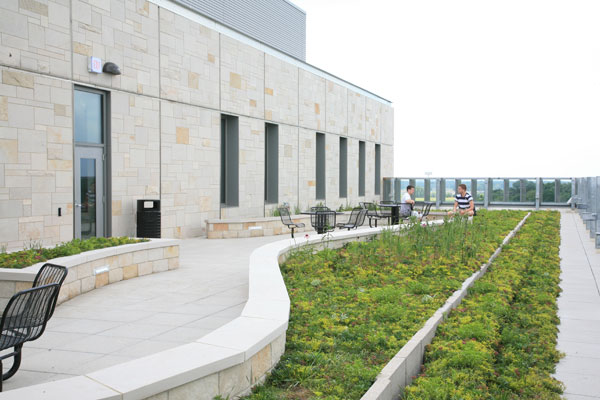
Drones are being used within the construction industry for site surveying and planning, measuring stockpiles, and to obtain real-time data for project progress, inspection, and monitoring. They have also been used to identify potential hazards or safety issues, in addition to providing major benefits for final and warranty inspections (Figure 3).
Data captured by some drone’s cameras can be subsequently exported to create 3D digital models or site plans. Some can also be programmed with automated flight paths, so consistent reproducible data can be captured. Additionally, infrared (IR) cameras can be fitted to drones, enabling them to capture thermographic images of roofs, solar panels, and electrical equipment, where changes in recorded temperature can indicate either uniformity or the existence of problems (Figure 4).
Concrete and masonry inspections, along with asset monitoring
In the middle of last year, this author began to use drones to assist in his established consulting practice, which includes condition assessments and inspections of concrete and masonry structures. Since that time, more than 35 buildings have been inspected, including three tall freestanding chimneys. Following the inspections, images extracted from video have been used for a variety of purposes. In Figure 4, for example, overhead aerial views have been used to develop site plans for inclusion in condition assessment reports and contract drawings.
Figure 5 illustrates drone inspections carried out on two tall freestanding chimneys. The first was a 27.4-m (90-ft) high abandoned chimney that had never been capped. The inspection—requested because debris had collected at its base—revealed considerable damage to the 19th-century brick masonry at the top of the stack. As a result, emergency repairs were undertaken to stabilize the masonry until full restoration work could be carried out. The masonry mortar joints of the second chimney—a 26.7-m (115-ft) brick stack—were known to have deteriorated, and restoration work was scheduled to take place. The use of a drone was necessary to convey the extent of the work to the bidding contractors. Images extracted from video footage were detailed on contract drawings, and the video, which formed part of the subsequent contract, was provided to the bidders on a USB flash drive so they could accurately assess quantities for their bids.
Some facility managers have begun to use drone inspections in order to thoroughly record the condition of their asset stock so meaningful comparisons can be made in the future. Investigations using mechanical access equipment, where damage is only photographically recorded, can sometimes be confusing when new deterioration is discovered. This is because it can often be difficult to determine whether the damage had been present, but not detected during a previous inspection. However, perhaps the most beneficial use of drones for building and structure investigations is when costly mechanical boom-trucks, swing-stages, or scissor-lifts can be avoided—especially where access is difficult or landscaping could otherwise become damaged (Figure 6).
A natural application for drone technology is the inspection of roofs where damage may not be readily viewable from grade level (Figure 7). Although not a substitute for closeup physical examination, the ease and speed of a drone inspection can be a valuable tool when determining whether or not access to a roof is necessary.
Sign up for our weekly newsletter
Construction Canada weekly newsletters give the latest AEC industry news for those who build, design, engineer, specify, renovate or operate in the built environment.
Products & Services
Read the Latest Issue
